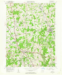
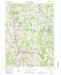
1953 Map of Mars
USGS Topo · Published 1963About this map
Mars serves as a primary hub within this 1953 survey, which captures the southern Butler and northern Allegheny County borderlands as suburban development began to reach these rural townships. The landscape is defined by a dense network of Oil Wells scattered across the hills, signaling the region’s long-standing petroleum industry. Significant social and institutional footprints are visible at the Thorn Hill Industrial School and various youth camps like Epworth Woods Camp and Camp Trees, which utilized the wooded terrain of Marshall and Pine townships.
Find a feature on this map
62 named features on this map. Tap any name to fly to it.
Don’t see what you’re looking for? This feature index may not catch every label — zoom into the map to look around manually.
Map Details
Editions of this 1953 Mars Map
5 editions found
Other maps of this area

1906 · Sewickley
USGS Topo · 1:62,500

1908 · Sewickley
USGS Topo · 1:62,500

1908 · New Kensington
USGS Topo · 1:62,500

1908 · Zelienople
USGS Topo · 1:62,500

1909 · Butler
USGS Topo · 1:62,500

1910 · New Kensington
USGS Topo · 1:62,500

1910 · Zelienople
USGS Topo · 1:62,500

1911 · Butler
USGS Topo · 1:62,500

1950 · Valencia
USGS Topo · 1:24,000

1951 · Canton
USGS Topo · 1:250,000