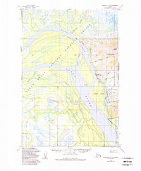
1952 Map of Marshall D-1
USGS Topo · Published 1988About this map
The Yukon River dominates this landscape, weaving through a complex network of wetlands and seasonal waterways within the Yukon Delta National Wildlife Refuge. The settlement of Marshall, also identified by its historical post office name Fortuna Ledge, serves as a primary hub for this stretch of the river. Nearby, smaller riverside locations like Takshak, The Bluff, and Ingrihak illustrate the pattern of human habitation along the banks and sloughs.
Find a feature on this map
26 named features on this map. Tap any name to fly to it.
Don’t see what you’re looking for? This feature index may not catch every label — zoom into the map to look around manually.
Map Details
Editions of this 1952 Marshall D-1 Map
3 editions found
Other maps of this area

1947 · Russian Mission
USGS Topo · 1:250,000

1950 · Russian Mission
USGS Topo · 1:250,000

1951 · Marshall
USGS Topo · 1:250,000

1951 · Holy Cross
USGS Topo · 1:250,000

1952 · Kwiguk
USGS Topo · 1:250,000

1952 · Kwiguk A-1
USGS Topo · 1:63,360

1952 · Holy Cross A-6
USGS Topo · 1:63,360

1952 · Holy Cross
USGS Topo · 1:250,000

1952 · Russian Mission C-8
USGS Topo · 1:63,360
1952 · Russian Mission D-8
USGS Topo · 1:63,360