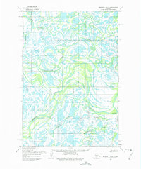
1952 Map of Marshall D-6
USGS Topo · Published 1975About this map
Owl Village stands as the primary human settlement in this sprawling delta landscape, situated amidst a complex network of active and abandoned river channels. This 1952 topographic survey, based on aerial photography from the early 1950s, reveals a highly dynamic hydrological environment where the Black River and Kipungolak River meander through marshy lowlands. The intricate drainage patterns of the Kashunuk River and Nungatak River characterize the southern portion of the sheet, reflecting the geological processes of the Yukon-Kuskokwim Delta region. The lack of roads or established trails emphasizes the reliance on these waterways, such as the Manokinak River, for travel and subsistence. This map provides a detailed record of the natural terrain and indigenous place names before later 20th-century shifts in climate and hydrology altered the landscape.
Find a feature on this map
8 named features on this map. Tap any name to fly to it.
Don’t see what you’re looking for? This feature index may not catch every label — zoom into the map to look around manually.
Map Details
Editions of this 1952 Marshall D-6 Map
2 editions found
Other maps of this area

1951 · Marshall
USGS Topo · 1:250,000

1952 · Kwiguk
USGS Topo · 1:250,000

1952 · Kwiguk A-5
USGS Topo · 1:63,360

1952 · Kwiguk A-4
USGS Topo · 1:63,360

1952 · Marshall D-5
USGS Topo · 1:63,360

1952 · Marshall C-7
USGS Topo · 1:63,360

1952 · Marshall C-6
USGS Topo · 1:63,360

1952 · Marshall C-5
USGS Topo · 1:63,360
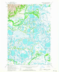
1952 · Marshall D-7
USGS Topo · 1:63,360

1952 · Marshall D-6
USGS Topo · 1:63,360