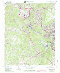
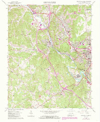
1965 Map of Martinsville West
USGS Topo · Published 1984About this map
The Smith River snakes through the heart of Henry County, carving a valley that dictated the industrial and residential growth of the region into the mid-1960s. The manufacturing influence is evident in the dense development between Fieldale and Koehler, where the Norfolk and Western Railroad follows the river's bend to serve local industry. Educational and civic life are anchored by landmarks like Fieldale-Collinsville High Sch and Carver Sch, while the city of Martinsville expands westward with residential developments like Villa Heights.
Find a feature on this map
66 named features on this map. Tap any name to fly to it.
Don’t see what you’re looking for? This feature index may not catch every label — zoom into the map to look around manually.
Map Details
Editions of this 1965 Martinsville West Map
5 editions found
Other maps of this area

1924 · Martinsville
USGS Topo · 1:48,000

1925 · Rocky Mount
USGS Topo · 1:48,000

1926 · Martinsville
USGS Topo · 1:62,500

1926 · Critz
USGS Topo · 1:48,000

1927 · Rocky Mount
USGS Topo · 1:62,500

1927 · Martinsville
USGS Topo · 1:62,500

1928 · Critz
USGS Topo · 1:62,500

1944 · Martinsville
USGS Topo · 1:62,500

1944 · Rocky Mount
USGS Topo · 1:62,500

1953 · Winston-Salem
USGS Topo · 1:250,000