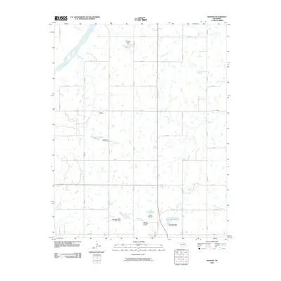
2009 Map of Masham
USGS Topo · Published 2009About this map
The Arkansas River carves through the northwest corner of this Pawnee County landscape, defining a rural Oklahoma territory characterized by an intricate system of water management. Numerous reservoirs and dams, including the Oknoname 117001 Reservoir and the Lower Black Bear Creek Site 3 Reservoir, are scattered throughout the quadrangle, illustrating a high degree of hydrological control over the local drainage basins of Skedee Creek and Coon Creek.
Find a feature on this map
40 named features on this map. Tap any name to fly to it.
Don’t see what you’re looking for? This feature index may not catch every label — zoom into the map to look around manually.
Map Details
Editions of this 2009 Masham Map
This is the sole edition of this map. No revisions or reprints were ever made.
Other maps of this area

1929 · Skedee
USGS Topo · 1:62,500

1930 · Pawnee
USGS Topo · 1:62,500

1931 · Skedee
USGS Topo · 1:62,500

1932 · Fairfax
USGS Topo · 1:62,500

1936 · Belford
USGS Topo · 1:62,500

1936 · Pawnee
USGS Topo · 1:62,500

1955 · Enid
USGS Topo · 1:250,000

1958 · Enid
USGS Topo · 1:250,000
1978 · Prettyhair Creek
USGS Topo · 1:24,000
1978 · Pawnee
USGS Topo · 1:24,000