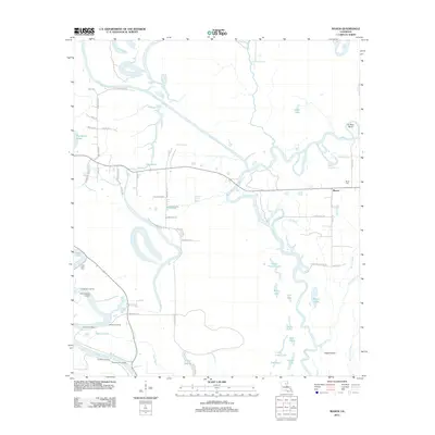
2012 Map of Mason
USGS Topo · Published 2012About this map
The Boeuf River and Ouachita River dominate this Franklin Parish landscape, defining a complex network of waterways and lowlands in the early 21st century. The settlement of Mason sits on the eastern side of the survey, characterized by a grid of rural roads and its proximity to Joe Bayou. Along the winding banks of the Ouachita, a series of riverfront locations like Marshall Landing, Fredericksburg Landing, and Oak Bluff Landing point to the area's long-standing connection to river transport and regional commerce.
Find a feature on this map
71 named features on this map. Tap any name to fly to it.
Don’t see what you’re looking for? This feature index may not catch every label — zoom into the map to look around manually.
Map Details
Editions of this 2012 Mason Map
This is the sole edition of this map. No revisions or reprints were ever made.
Other maps of this area

1939 · Fort Necessity
USGS Topo · 1:62,500

1940 · Columbia
USGS Topo · 1:62,500

1941 · Harrisonburg
USGS Topo · 1:62,500

1953 · Alexandria
USGS Topo · 1:250,000

1953 · Natchez
USGS Topo · 1:250,000

1955 · Jackson
USGS Topo · 1:250,000

1955 · Shreveport
USGS Topo · 1:250,000

1955 · Alexandria
USGS Topo · 1:250,000

1955 · Olla
USGS Topo · 1:62,500

1956 · Shreveport
USGS Topo · 1:250,000