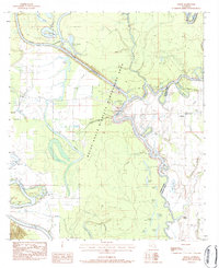
1983 Map of Mason
USGS Topo · Published 1984About this map
The Boeuf River and Bayou Lafourche dominate this Louisiana landscape at the boundary of Caldwell and Franklin Parishes. This 1980s survey captures a complex network of wetlands and oxbow formations, including the sprawling Boeuf State Wildlife Management Area and smaller bodies like Sawyer Pond and Locust Thicket Lake. The presence of the Crew Bayou Cutoff and several gaging stations suggests a highly managed river system during this era.
Find a feature on this map
48 named features on this map. Tap any name to fly to it.
Don’t see what you’re looking for? This feature index may not catch every label — zoom into the map to look around manually.
Map Details
Editions of this 1983 Mason Map
This is the sole edition of this map. No revisions or reprints were ever made.
Other maps of this area

1939 · Fort Necessity
USGS Topo · 1:62,500

1940 · Columbia
USGS Topo · 1:62,500

1941 · Harrisonburg
USGS Topo · 1:62,500

1953 · Alexandria
USGS Topo · 1:250,000

1953 · Natchez
USGS Topo · 1:250,000

1955 · Jackson
USGS Topo · 1:250,000

1955 · Shreveport
USGS Topo · 1:250,000

1955 · Alexandria
USGS Topo · 1:250,000

1955 · Olla
USGS Topo · 1:62,500

1956 · Shreveport
USGS Topo · 1:250,000