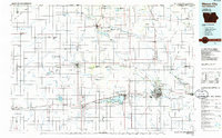
1985 Map of Mason City
USGS Topo · Published 1985About this map
Mason City and the surrounding expanse of Northern Iowa and Southern Minnesota appear here in the mid-1980s, revealing a landscape defined by an intensive agricultural drainage network and established rail corridors. The intricate system of ditches, such as Ditch No 21 and Ditch No 64, illustrates the massive 20th-century effort to reclaim the prairie wetlands for farming. This map captures the region's transport nodes, where the Chicago and North Western and Chicago Milwaukee St Paul and Pacific railroads intersect with the growing interstate system of I-35. Natural and recreational anchors like Clear Lake State Park and Pilot Knob State Park stand in contrast to the rigid section-line grid. Smaller settlements including Nora Springs, Lake Mills, and Northwood serve as local centers for the rural townships, while the Shell Rock River and Cedar River provide the primary natural drainage through the eastern portion of the quadrangle.
Find a feature on this map
137 named features on this map. Tap any name to fly to it.
Don’t see what you’re looking for? This feature index may not catch every label — zoom into the map to look around manually.
Map Details
Editions of this 1985 Mason City Map
2 editions found
Other maps of this area

1954 · Albert Lea
USGS Topo · 1:62,500

1954 · Hayward
USGS Topo · 1:62,500

1954 · Austin
USGS Topo · 1:62,500

1954 · Fairmont
USGS Topo · 1:250,000

1954 · Mason City
USGS Topo · 1:250,000

1954 · Waterloo
USGS Topo · 1:250,000

1954 · Fort Dodge
USGS Topo · 1:250,000

1955 · Waterloo
USGS Topo · 1:250,000

1955 · Bricelyn
USGS Topo · 1:62,500

1955 · Wells
USGS Topo · 1:62,500