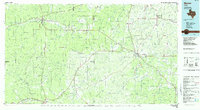
1985 Map of Mason
USGS Topo · Published 1985About this map
Mason and Menard serve as the primary hubs in this mid-1980s look at the Hill Country, where the rolling landscape is defined by the San Saba River and Llano River systems. The map details the transition from the high ridges of the Mason Mountains and Blue Mountains to the fertile creek bottoms of Twelvemile Creek and Honey Creek. Smaller communities like London, Hext, and Grit are connected by a network of state and U.S. highways, illustrating the rural settlement pattern of Mason and Menard counties.
Find a feature on this map
115 named features on this map. Tap any name to fly to it.
Don’t see what you’re looking for? This feature index may not catch every label — zoom into the map to look around manually.
Map Details
Editions of this 1985 Mason Map
2 editions found
Other maps of this area

1885 · San Saba
USGS Topo · 1:125,000

1887 · Llano
USGS Topo · 1:125,000

1887 · Mason
USGS Topo · 1:125,000

1892 · San Angelo
USGS Topo · 1:125,000

1892 · Eden
USGS Topo · 1:125,000

1893 · Rock Springs
USGS Topo · 1:125,000

1893 · Fort McKavett
USGS Topo · 1:125,000

1894 · Brady
USGS Topo · 1:125,000

1894 · Mason
USGS Topo · 1:125,000

1894 · Fredericksburg
USGS Topo · 1:125,000