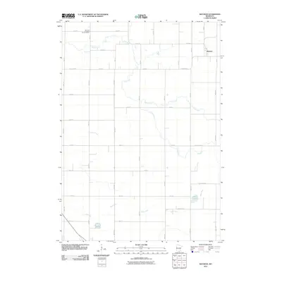
2010 Map of Matawan
USGS Topo · Published 2010About this map
The Cobb River and its tributary, Cobb Creek, wind through a landscape defined by systematic agricultural sectioning north of Wells. This rural area of Faribault County is anchored by the small settlement of Matawan in the northeast, positioned at the intersection of 65th St and 210th Ave. The map reveals the region's spiritual and genealogical history through the Saint Paul Evangelical Church Cemetery located near the headwaters of the river system. In the southern portion of the quadrangle, the Maple River flows westward, passing just north of Penny Lake. This document provides a clear look at the early 21st-century road network, including County Hwy-32 and County Hwy-11, which serve the local farming community.
Find a feature on this map
34 named features on this map. Tap any name to fly to it.
Don’t see what you’re looking for? This feature index may not catch every label — zoom into the map to look around manually.
Map Details
Editions of this 2010 Matawan Map
This is the sole edition of this map. No revisions or reprints were ever made.
Other maps of this area

1954 · Mason City
USGS Topo · 1:250,000

1955 · Bricelyn
USGS Topo · 1:62,500

1955 · Wells
USGS Topo · 1:62,500

1957 · Mason City
USGS Topo · 1:250,000

1958 · Mason City
USGS Topo · 1:250,000

1967 · Minnesota Lake
USGS Topo · 1:24,000

1967 · Waldorf
USGS Topo · 1:24,000

1967 · Freeborn
USGS Topo · 1:24,000
1967 · Otisco
USGS Topo · 1:24,000
1967 · Matawan
USGS Topo · 1:24,000