
1949 Map of Matchwood NW
USGS Topo · Published 1949About this map
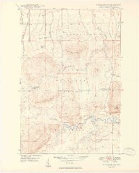
The Ottawa National Forest dominates this section of the Upper Peninsula, where the landscape is defined by the drainage of the Ontonagon River and its various branches. Surveyed shortly after World War II, the map reveals a wilderness area sparingly marked by human activity, such as the isolated Mac Intosh Cabin and a lone Artesian Well. The steep terrain is highlighted by the presence of the Norwich Lookout Tower on a high ridge, which served as a critical vantage point for fire detection in the timber-heavy region. Water is the primary feature of the geography here, from the rushing Cascade Falls to the meandering paths of Town Line Creek and the Cranberry River. Small industrial markers, including several Gravel Pits, indicate the local materials used for road building in this remote forest interior.
Find a feature on this map
17 named features on this map. Tap any name to fly to it.
Don’t see what you’re looking for? This feature index may not catch every label — zoom into the map to look around manually.
Map Details
Editions of this 1949 Matchwood NW Map
2 editions found
Other maps of this area

1949 · White Pine
USGS Topo · 1:24,000

1949 · Bergland NE
USGS Topo · 1:24,000

1955 · Ontonagon
USGS Topo · 1:62,500

1956 · Bergland NE
USGS Topo · 1:24,000

1956 · Bergland
USGS Topo · 1:62,500

1956 · White Pine
USGS Topo · 1:24,000

1956 · Matchwood NW
USGS Topo · 1:24,000

1956 · White Pine
USGS Topo · 1:62,500

1956 · Matchwood
USGS Topo · 1:62,500

1958 · Iron River
USGS Topo · 1:250,000