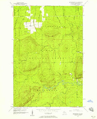
1956 Map of Matchwood NW
USGS Topo · Published 1958About this map
The Ottawa National Forest encompasses this section of the western Upper Peninsula, where the Carp Lake Mountains rise above a complex network of waterways. The landscape is defined by the heavy presence of the Ontonagon River and its West Branch Ontonagon River, which includes the notable Cascade Falls. This 1956 revision captures the industrial and logistical remnants of the region's mining and timber heritage, most notably at the Norwich Mine and the nearby Norwich Lookout Tower. Traces of earlier infrastructure are evident in the Old Grade Railroad, which runs through the northern sections near Duck Creek. The mapping of features like the Flowing Well and numerous small creeks such as Argentine Creek and Halfway Creek provides a precise view of the remote drainage patterns in Ontonagon County during the mid-20th century.
Find a feature on this map
66 named features on this map. Tap any name to fly to it.
Don’t see what you’re looking for? This feature index may not catch every label — zoom into the map to look around manually.
Map Details
Editions of this 1956 Matchwood NW Map
3 editions found
Other maps of this area

1949 · Matchwood NW
USGS Topo · 1:24,000

1949 · White Pine
USGS Topo · 1:24,000

1949 · Bergland NE
USGS Topo · 1:24,000

1955 · Ontonagon
USGS Topo · 1:62,500

1956 · Bergland NE
USGS Topo · 1:24,000

1956 · Bergland
USGS Topo · 1:62,500

1956 · White Pine
USGS Topo · 1:24,000

1956 · Matchwood NW
USGS Topo · 1:24,000

1956 · White Pine
USGS Topo · 1:62,500

1956 · Matchwood
USGS Topo · 1:62,500