1906 Map of Matinicus
USGS Topo · Published 1943About this map
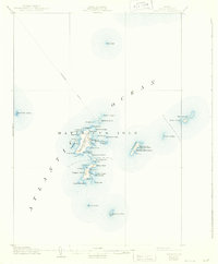
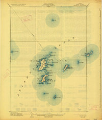
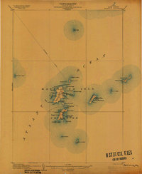
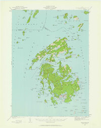
Matinicus Isle and its surrounding archipelago represent one of the most isolated outposts in the Atlantic Ocean off the Maine coast. This 1904 revision, published in the mid-1940s, documents the maritime life of the Knox County islands before modern automation. The primary settlement of Matinicus is centered near the harbor, while further south, the community at Criehaven on Ragged Island marks another remote center of habitation. A prominent Steamboat Route cuts across the western waters, indicating the vital transport link that connected these seafaring residents to the mainland.
Find a feature on this map
57 named features on this map. Tap any name to fly to it.
Don’t see what you’re looking for? This feature index may not catch every label — zoom into the map to look around manually.
Map Details
Editions of this 1906 Matinicus Map
4 editions found

Other maps of this area

1904 · Deer Isle
USGS Topo · 1:62,500

1904 · Vinalhaven
USGS Topo · 1:62,500

1904 · Tenants Harbor
USGS Topo · 1:62,500

1904 · Rockland
USGS Topo · 1:62,500

1905 · Penobscot Bay
USGS Topo · 1:125,000
1906 · Matinicus
USGS Topo · 1:62,500

1906 · Tennant Harbor
USGS Topo · 1:62,500

1906 · Rockland
USGS Topo · 1:62,500

1941 · Rockland
USGS Topo · 1:62,500
1941 · Vinalhaven
USGS Topo · 1:62,500
Featured Places
- Vinalhaven, ME
- Matinicus Isle Plantation, ME
- Matinicus Isle, Matinicus Isle Plantation
- Criehaven Township, ME
- Muscle Ridge Township, ME