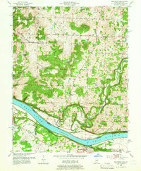
1950 Map of Mauckport
USGS Topo · Published 1954About this map
Mauckport serves as a focal point along the northern bank of the Ohio River, where the river's winding course defines the border between Indiana and Kentucky. This mid-century survey captures a rural landscape transitioning from the riverfront bottoms to the high ridges of the Harrison-Crawford State Forest. The map documents a network of small settlements like Valley City and Central, along with numerous country churches that anchored these communities, including Wesley Chapel and Mt Zion Ch.
Find a feature on this map
37 named features on this map. Tap any name to fly to it.
Don’t see what you’re looking for? This feature index may not catch every label — zoom into the map to look around manually.
Map Details
Editions of this 1950 Mauckport Map
3 editions found
Other maps of this area

1928 · Hardinsburg
USGS Topo · 1:48,000

1931 · Hardinsburg
USGS Topo · 1:62,500

1931 · Corydon
USGS Topo · 1:62,500

1941 · Ekron
USGS Topo · 1:62,500

1944 · Corydon West
USGS Topo · 1:24,000

1946 · Rock Haven
USGS Topo · 1:24,000

1946 · Leavenworth
USGS Topo · 1:24,000

1947 · Irvington
USGS Topo · 1:24,000

1947 · Leavenworth
USGS Topo · 1:24,000

1947 · Corydon West
USGS Topo · 1:24,000