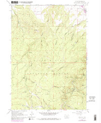
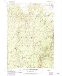
1961 Map of Maurice
USGS Topo · Published 1979About this map
Black Hills National Forest terrain dominates this 1960s study, revealing the complex water and transport systems established in the northern hills. The drainage network is particularly detailed, tracing the winding course of Spearfish Creek as it passes the community of Maurice. Infrastructure for water management and early travel is evident through the presence of a Pumping Station, an Aqueduct, and the historic Tollgate Road. This route winds through Sawmill Gulch and across the Flats, indicating the logistical patterns of timber and transit in the region.
Find a feature on this map
35 named features on this map. Tap any name to fly to it.
Don’t see what you’re looking for? This feature index may not catch every label — zoom into the map to look around manually.
Map Details
Editions of this 1961 Maurice Map
5 editions found
Other maps of this area

1894 · Deadwood
USGS Topo · 1:125,000

1898 · Sundance
USGS Topo · 1:125,000

1900 · Spearfish
USGS Topo · 1:62,500

1901 · Deadwood
USGS Topo · 1:125,000

1901 · Aladdin
USGS Topo · 1:125,000

1902 · Sundance
USGS Topo · 1:125,000

1903 · Aladdin
USGS Topo · 1:125,000

1907 · Belle Fourche
USGS Topo · 1:125,000

1907 · Redwater
USGS Topo · 1:62,500

1915 · Spearfish
USGS Topo · 1:62,500