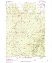
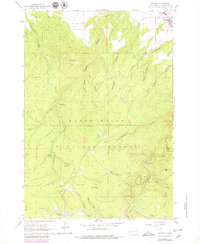
1961 Map of Maurice
USGS Topo · Published 1979About this map
Black Hills National Forest dominates this landscape, where the rugged topography is defined by deep gulches and high summits like Crow Peak and Little Crow Peak. The area serves as a vital watershed, mapped with numerous water sources including Big Spring, Higgins Spring, and Jay Spring. The settlement of Spearfish is visible at the northern edge, while the smaller locales of Maurice and Victoria are positioned near the confluence of Spearfish Creek and its many tributaries.
Find a feature on this map
36 named features on this map. Tap any name to fly to it.
Don’t see what you’re looking for? This feature index may not catch every label — zoom into the map to look around manually.
Map Details
Editions of this 1961 Maurice Map
5 editions found
Other maps of this area

1894 · Deadwood
USGS Topo · 1:125,000

1898 · Sundance
USGS Topo · 1:125,000

1900 · Spearfish
USGS Topo · 1:62,500

1901 · Deadwood
USGS Topo · 1:125,000

1901 · Aladdin
USGS Topo · 1:125,000

1902 · Sundance
USGS Topo · 1:125,000

1903 · Aladdin
USGS Topo · 1:125,000

1907 · Belle Fourche
USGS Topo · 1:125,000

1907 · Redwater
USGS Topo · 1:62,500

1915 · Spearfish
USGS Topo · 1:62,500