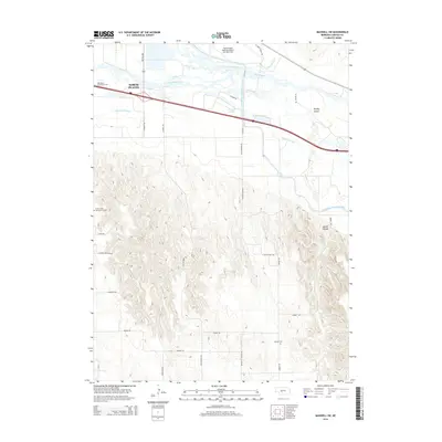
2014 Map of Maxwell SW
USGS Topo · Published 2014About this map
The confluence of the North Platte River and the South Platte River defines the landscape south of North Platte in this 2014 survey. This hydrological junction gives rise to the main Platte River, which weaves through a network of waterways and irrigation infrastructure, including the Tri-County Supply Canal and the Fremont Slough. The northern portion of the map is dominated by transportation and public infrastructure, including the North Platte Regional Airport Lee Bird Field and the Mid-Plains Community College campus. South of the river valley, the terrain shifts abruptly into the complex topography of the loess hills, where deep incisions like Moran Canyon break the upland surface. In these rural sections, researchers can find isolated local landmarks such as Mariam Cemetery and Floral Lawns Memorial Gardens, situated along an extensive grid of section-line roads like S Platte View Rd and Old Highway 83.
Find a feature on this map
34 named features on this map. Tap any name to fly to it.
Don’t see what you’re looking for? This feature index may not catch every label — zoom into the map to look around manually.
Map Details
Editions of this 2014 Maxwell SW Map
This is the sole edition of this map. No revisions or reprints were ever made.
Other maps of this area

1899 · North Platte
USGS Topo · 1:125,000

1902 · North Platte
USGS Topo · 1:125,000

1954 · McCook
USGS Topo · 1:250,000

1954 · North Platte
USGS Topo · 1:250,000

1956 · North Platte
USGS Topo · 1:250,000

1956 · Wellfleet NW
USGS Topo · 1:24,000

1956 · Wellfleet NE
USGS Topo · 1:24,000

1957 · North Platte
USGS Topo · 1:250,000

1957 · McCook
USGS Topo · 1:250,000

1958 · McCook
USGS Topo · 1:250,000