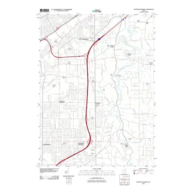
2010 Map of Mayfield Heights
USGS Topo · Published 2010About this map
Wickliffe Village Cemetery and Willoughby Ridge Cemetery anchor the northern landscape of this suburban Cuyahoga County corridor. The eastern edge is defined by the winding course of the Chagrin River, where the terrain transitions into the more open spaces of Pleasant Valley and the Gates Mills area. This map documents a densely developed region at the start of the 21st century, showing the complex web of residential streets and arterial roads like Lakeland Blvd and Gates Mills Blvd that connect Highland Heights and Mayfield Heights. Numerous leisure and memorial spaces are interspersed among the neighborhoods, from the Airport Greens Golf Course near the Cuyahoga County Airport to the expansive grounds of Knollwood Cemetery and Whitehaven Memorial Park. The map also captures specialized agricultural and natural sites such as the Schultz Fruit Farm and the Forest Picnic Area.
Find a feature on this map
85 named features on this map. Tap any name to fly to it.
Don’t see what you’re looking for? This feature index may not catch every label — zoom into the map to look around manually.
Map Details
Editions of this 2010 Mayfield Heights Map
This is the sole edition of this map. No revisions or reprints were ever made.
Other maps of this area

1901 · Euclid
USGS Topo · 1:62,500

1903 · Cleveland
USGS Topo · 1:62,500

1903 · Euclid
USGS Topo · 1:62,500

1905 · Mentor
USGS Topo · 1:62,500

1906 · Chagrin Falls
USGS Topo · 1:62,500

1907 · Mentor
USGS Topo · 1:62,500

1908 · Chagrin Falls
USGS Topo · 1:62,500

1950 · Cleveland
USGS Topo · 1:250,000

1953 · South Russell
USGS Topo · 1:24,000

1953 · Chagrin Falls
USGS Topo · 1:24,000