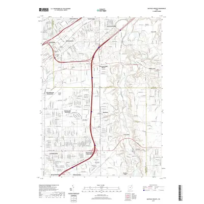
2019 Map of Mayfield Heights
USGS Topo · Published 2019About this map
The Chagrin River carves a deep valley through the eastern portion of this landscape, creating a distinct contrast between the dense suburban development of Mayfield Heights and the more open terrain of Gates Mills and Waite Hill. This 2019 survey captures the modern infrastructure of the eastern Cleveland suburbs, where I-271 and I-90 facilitate rapid transit through heavily residential and commercial sectors.
Find a feature on this map
54 named features on this map. Tap any name to fly to it.
Don’t see what you’re looking for? This feature index may not catch every label — zoom into the map to look around manually.
Map Details
Editions of this 2019 Mayfield Heights Map
This is the sole edition of this map. No revisions or reprints were ever made.
Other maps of this area

1901 · Euclid
USGS Topo · 1:62,500

1903 · Cleveland
USGS Topo · 1:62,500

1903 · Euclid
USGS Topo · 1:62,500

1905 · Mentor
USGS Topo · 1:62,500

1906 · Chagrin Falls
USGS Topo · 1:62,500

1907 · Mentor
USGS Topo · 1:62,500

1908 · Chagrin Falls
USGS Topo · 1:62,500

1950 · Cleveland
USGS Topo · 1:250,000

1953 · South Russell
USGS Topo · 1:24,000

1953 · Chagrin Falls
USGS Topo · 1:24,000