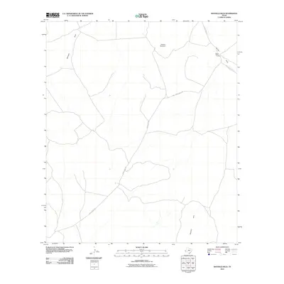
2010 Map of Mayfield Hills
USGS Topo · Published 2010About this map
Moon Ranch stands as a focal point in this high-desert landscape of Culberson County, situated where the terrain begins to rise toward the namesake Mayfield Hills. The map documents a sparsely settled region defined by its drainage patterns and ranching infrastructure during the early 21st century. High points like Hogeye Mountain overlook a network of seasonal watercourses, including Michigan Draw and Bunton Draw, which dictate the placement of local thoroughfares. Remote access is provided by unpaved tracks such as Moon Ranch Rd and Agua Caliente Lodge Rd, reflecting the enduring isolation of this pocket of the Trans-Pecos. This survey offers a clear view of the relationship between scarce water sources and human activity in a region where land use remains tied to the natural contours of the desert floor.
Find a feature on this map
7 named features on this map. Tap any name to fly to it.
Don’t see what you’re looking for? This feature index may not catch every label — zoom into the map to look around manually.
Map Details
Editions of this 2010 Mayfield Hills Map
This is the sole edition of this map. No revisions or reprints were ever made.
Other maps of this area

1892 · Chispa
USGS Topo · 1:125,000

1894 · Valentine
USGS Topo · 1:125,000

1895 · Chispa
USGS Topo · 1:125,000

1897 · Valentine
USGS Topo · 1:125,000

1897 · Chispa
USGS Topo · 1:125,000

1943 · Valentine
USGS Topo · 1:125,000

1959 · Marfa
USGS Topo · 1:250,000

1965 · Marfa
USGS Topo · 1:250,000
1972 · Chispa Mountain NW
USGS Topo · 1:24,000

1972 · Chispa
USGS Topo · 1:24,000