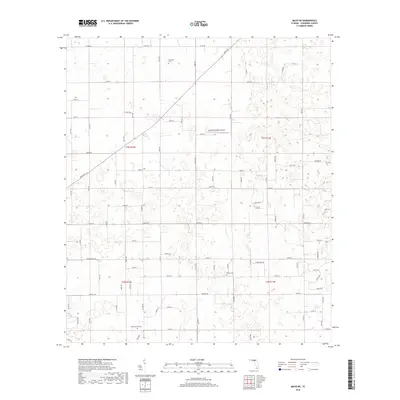
2018 Map of Mayo NE
USGS Topo · Published 2018About this map
The rural landscape of northern Suwannee County is defined by a dense grid of local roads and quiet cemeteries. Small, family or community burial grounds such as Claywood Cem, Smith Cem, and Mount Willing Cem are dispersed across the township boundaries of t3s r12e and t4s r13e, reflecting the area's deep-rooted agricultural settlement patterns. The terrain is relatively flat, marked by a complex network of county roads including Co Rd 250 and Co Rd 349. A notable modern landmark is the Cooksey Brothers Airport, which occupies a central position among the numbered streets and avenues. This collection of local ways, from Irvin Ave to 161st Rd, illustrates the methodical organization of Florida's inland counties in the early 21st century.
Find a feature on this map
77 named features on this map. Tap any name to fly to it.
Don’t see what you’re looking for? This feature index may not catch every label — zoom into the map to look around manually.
Map Details
Editions of this 2018 Mayo NE Map
This is the sole edition of this map. No revisions or reprints were ever made.
Other maps of this area

1954 · Dowling Park
USGS Topo · 1:24,000

1954 · Valdosta
USGS Topo · 1:250,000

1955 · Mayo NE
USGS Topo · 1:24,000

1955 · Mayo
USGS Topo · 1:24,000

1955 · Mayo SE
USGS Topo · 1:24,000

1958 · Valdosta
USGS Topo · 1:250,000

1959 · Valdosta
USGS Topo · 1:250,000

1959 · Live Oak West
USGS Topo · 1:24,000

1959 · Falmouth
USGS Topo · 1:24,000

1961 · Live Oak East
USGS Topo · 1:24,000