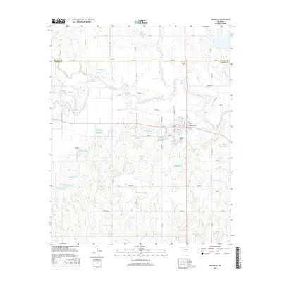
2016 Map of Maysville
USGS Topo · Published 2016About this map
The Washita River meanders across the landscape near the border of McClain and Garvin counties, shaping the rural environment around the town of Maysville. This 2016 survey illustrates a region defined by extensive water management, featuring a dense network of reservoirs including the Maysville Laterals Site B1 Reservoir and several others in the B and H series. These catchments, along with tributaries like Finn Creek and Criner Creek, support the agricultural character of the valley.
Find a feature on this map
64 named features on this map. Tap any name to fly to it.
Don’t see what you’re looking for? This feature index may not catch every label — zoom into the map to look around manually.
Map Details
Editions of this 2016 Maysville Map
This is the sole edition of this map. No revisions or reprints were ever made.
Other maps of this area

1898 · Pauls Valley
USGS Topo · 1:125,000

1902 · Pauls Valley
USGS Topo · 1:125,000

1902 · Rush Springs
USGS Topo · 1:125,000

1957 · Ardmore
USGS Topo · 1:250,000

1963 · Ardmore
USGS Topo · 1:250,000
1965 · Wayne
USGS Topo · 1:24,000

1965 · Maysville
USGS Topo · 1:24,000

1965 · Paoli
USGS Topo · 1:24,000
1965 · Stealy
USGS Topo · 1:24,000

1966 · Lindsay
USGS Topo · 1:24,000