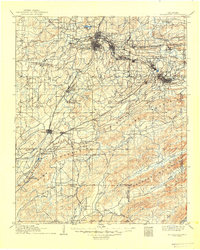
1909 Map of Mc Alester
USGS Topo · Published 1949About this map
The growing coal and rail centers of McAlester and Hartshorne dominate this Oklahoma territory landscape during a period of rapid development. The intricate network of the Chicago Rock Island and Pacific and the Missouri Kansas and Texas railroads highlights the region's early industrial importance, connecting mining settlements like Krebs, Alderson, and Carbon. Beyond the urban centers, the topography is defined by the sharp elevations of Limestone Ridge and Pine Mountain, which drop south toward the Red River Base Line. Smaller communities such as Perryville and Kiowa sit along established transit corridors, while the presence of the Haywood P O and Barnett Sta indicates the spread of postal and transport infrastructure into the more isolated valleys near McGee Creek.
Find a feature on this map
71 named features on this map. Tap any name to fly to it.
Don’t see what you’re looking for? This feature index may not catch every label — zoom into the map to look around manually.
Map Details
Editions of this 1909 Mc Alester Map
3 editions found

Other maps of this area

1896 · Coalgate
USGS Topo · 1:125,000

1898 · McAlester
USGS Topo · 1:125,000

1899 · Coalgate
USGS Topo · 1:125,000

1899 · Atoka
USGS Topo · 1:125,000

1900 · Sansbois
USGS Topo · 1:125,000

1900 · Canadian
USGS Topo · 1:125,000

1900 · Wewoka
USGS Topo · 1:125,000

1900 · Atoka
USGS Topo · 1:125,000

1900 · Coalgate
USGS Topo · 1:125,000

1901 · Antlers
USGS Topo · 1:125,000