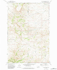
1971 Map of Mc Clure Creek
USGS Topo · Published 1983About this map
The Little Wolf Mountains dominate the southwestern corner of this landscape along the border of Rosebud and Treasure counties. This 1971 field-checked survey reveals a rugged ranching and resource territory defined by an intricate network of drainage systems including McClure Creek and Robbie Creek. The prevalence of numerous mapped Spring and Well points across the high country underscores the critical importance of water management in this arid Montana terrain. Evidence of modern infrastructure is sparse but notable, marked by a remote Pipeline and a solitary Landing Strip in the northeast near North Fork Trail Cr, suggesting the era's reliance on aerial access and energy transport. The map also traces the winding courses of Donley Creek and Horse Creek, providing a clear record of the local topography before further modern development altered the drainage basins.
Find a feature on this map
18 named features on this map. Tap any name to fly to it.
Don’t see what you’re looking for? This feature index may not catch every label — zoom into the map to look around manually.
Map Details
Editions of this 1971 Mc Clure Creek Map
2 editions found
Other maps of this area

1954 · Hardin
USGS Topo · 1:250,000

1954 · Forsyth
USGS Topo · 1:250,000

1957 · Hardin
USGS Topo · 1:250,000

1957 · Forsyth
USGS Topo · 1:250,000

1958 · Forsyth
USGS Topo · 1:250,000

1958 · Hardin
USGS Topo · 1:250,000

1971 · Trail Creek School
USGS Topo · 1:24,000

1971 · Mc Clure Creek
USGS Topo · 1:24,000

1971 · Griffin Coulee SW
USGS Topo · 1:24,000

1971 · Rough Draw
USGS Topo · 1:24,000