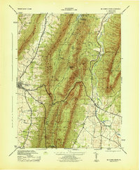
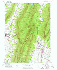
1944 Map of Mc Connellsburg
USGS Topo · Published 1944About this map
McConnellsburg serves as the focal point of this 1944 War Department survey, situated at the base of Cove Mountain. The landscape is dominated by the massive parallel ridges of Tuscarora Mountain and Kittatinny Mountain, which create the distinct valleys of Licking Creek and the West Branch Conococheague Creek. This wartime topography highlights critical infrastructure and resource management, such as the Mt Parnell Fish Hatchery and the Mercersburg Water Company Reservoir.
Find a feature on this map
52 named features on this map. Tap any name to fly to it.
Don’t see what you’re looking for? This feature index may not catch every label — zoom into the map to look around manually.
Map Details
Editions of this 1944 Mc Connellsburg Map
5 editions found
Other maps of this area

1900 · Mercersburg
USGS Topo · 1:62,500

1902 · Mercersburg
USGS Topo · 1:62,500

1925 · Needmore
USGS Topo · 1:48,000

1930 · Broad Top
USGS Topo · 1:62,500

1933 · Broad Top
USGS Topo · 1:62,500

1935 · Needmore
USGS Topo · 1:62,500

1939 · Needmore
USGS Topo · 1:62,500

1939 · Orbisonia
USGS Topo · 1:62,500

1940 · Orbisonia
USGS Topo · 1:62,500

1942 · Hagerstown
USGS Topo · 1:125,000