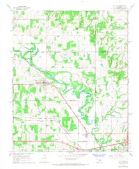
1966 Map of Mc Loud
USGS Topo · Published 1968About this map
The North Canadian River meanders across this mid-1960s landscape, serving as a geographic anchor for the town of Mc Loud and the surrounding borderlands of Lincoln and Pottawatomie counties. The area is characterized by its tribal history and rural infrastructure, most notably the Kickapoo Mission and several family-named burial grounds like Jent Cem and Abrams Cem. Transportation dominates the southern reaches, where the Chicago Rock Island and Pacific and the Atchison Topeka and Santa Fe rail lines converge near the community of Dale. A mix of industry and community life is evident in the Mc Loud Gas Field and landmarks like the Wagon Wheel Sch and Community Hall. These details illustrate a transitional period when small-scale agriculture and early energy development coexisted with established rural settlements.
Find a feature on this map
35 named features on this map. Tap any name to fly to it.
Don’t see what you’re looking for? This feature index may not catch every label — zoom into the map to look around manually.
Map Details
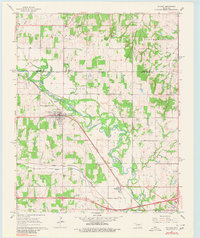
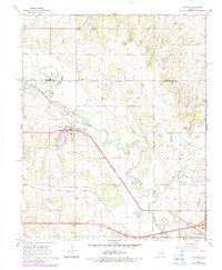
Editions of this 1966 Mc Loud Map
3 editions found
Other maps of this area

1896 · Seminole and Prague
USGS Topo · 1:125,000

1898 · Purcell
USGS Topo · 1:125,000

1905 · Chandler
USGS Topo · 1:62,500

1907 · Chandler
USGS Topo · 1:62,500

1909 · Shawnee
USGS Topo · 1:62,500

1909 · Luther
USGS Topo · 1:62,500

1930 · McLoud
USGS Topo · 1:62,500

1954 · Oklahoma City
USGS Topo · 1:250,000

1956 · Harrah
USGS Topo · 1:24,000

1956 · Horseshoe Lake
USGS Topo · 1:24,000