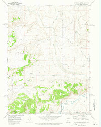
1970 Map of Mc Pherson Springs
USGS Topo · Published 1973About this map
Mcpherson Springs sits as a vital water point in this high-desert landscape, captured during a 1970 field check of the borderlands between Wyoming and Colorado. The terrain is defined by the Little Snake River winding through the southern portion of the map, carving a path near the Cherokee Rim and the broad Cherokee Basin. This area reflects a mid-century period of resource exploration, evidenced by numerous drill holes and an oil well scattered across the basin floor.
Find a feature on this map
38 named features on this map. Tap any name to fly to it.
Don’t see what you’re looking for? This feature index may not catch every label — zoom into the map to look around manually.
Map Details
Editions of this 1970 Mc Pherson Springs Map
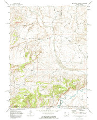
2 editions found
Other maps of this area

1916 · Craig
USGS Topo · 1:125,000

1954 · Vernal
USGS Topo · 1:250,000

1954 · Rawlins
USGS Topo · 1:250,000

1954 · Rock Springs
USGS Topo · 1:250,000

1954 · Craig
USGS Topo · 1:250,000

1957 · Craig
USGS Topo · 1:250,000

1958 · Rawlins
USGS Topo · 1:250,000

1958 · Vernal
USGS Topo · 1:250,000

1958 · Rock Springs
USGS Topo · 1:250,000

1958 · Craig
USGS Topo · 1:250,000