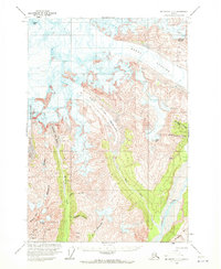
1959 Map of McCarthy C-5
USGS Topo · Published 1972About this map
Regal Mtn and the massive Regal Glacier dominate this high-alpine landscape of the Wrangell Mountains, captured during a 1950s field survey. The map details a complex glacial system where the West Fork Glacier and McCarthy Creek Glacier descend toward the valley floor. Evidence of human activity and exploration is present even in this high-altitude terrain, marked by a Landing Strip and a network of Trails that navigate the slopes near the Nizina River. To the west, Bonanza Ridge stands as a prominent landmark between McCarthy Creek and Bonanza Creek. This survey provides precise topographic detail for the area's many peaks, including Nizina Mtn and Bonanza Peak, reflecting the geologic complexity of the Amazon Gulch and Green Butte localities.
Find a feature on this map
27 named features on this map. Tap any name to fly to it.
Don’t see what you’re looking for? This feature index may not catch every label — zoom into the map to look around manually.
Map Details
Editions of this 1959 McCarthy C-5 Map
4 editions found
Other maps of this area

1951 · McCarthy
USGS Topo · 1:250,000

1959 · McCarthy B-6
USGS Topo · 1:63,360

1959 · McCarthy C-5
USGS Topo · 1:63,360

1959 · McCarthy B-5
USGS Topo · 1:63,360

1959 · McCarthy C-4
USGS Topo · 1:63,360

1959 · McCarthy B-4
USGS Topo · 1:63,360

1959 · McCarthy C-6
USGS Topo · 1:63,360

1960 · McCarthy D-6
USGS Topo · 1:63,360
1960 · McCarthy D-5
USGS Topo · 1:63,360

1960 · McCarthy D-4
USGS Topo · 1:63,360