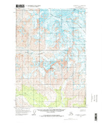
1959 Map of McCarthy C-7
USGS Topo · Published 1977About this map
Mount Blackburn dominates the northern reaches of this glacial landscape, serving as a massive drainage divide for the ice fields of the Wrangell Mountains. In the late 1950s, when this topography was field-annotated, the region was defined by massive active ice flows including the Kennicott Glacier and Kuskulana Glacier. These ice bodies feed an intricate network of waterways such as the Lakina River and Chokosna River, which carve through the high-elevation terrain.
Find a feature on this map
11 named features on this map. Tap any name to fly to it.
Don’t see what you’re looking for? This feature index may not catch every label — zoom into the map to look around manually.
Map Details
Editions of this 1959 McCarthy C-7 Map
3 editions found
Other maps of this area

1951 · McCarthy
USGS Topo · 1:250,000

1951 · McCarthy C-8
USGS Topo · 1:63,360

1951 · McCarthy B-8
USGS Topo · 1:63,360

1959 · McCarthy B-6
USGS Topo · 1:63,360

1959 · McCarthy D-7
USGS Topo · 1:63,360

1959 · McCarthy C-6
USGS Topo · 1:63,360

1959 · McCarthy C-7
USGS Topo · 1:63,360

1959 · McCarthy B-7
USGS Topo · 1:63,360

1960 · McCarthy D-8
USGS Topo · 1:63,360

1960 · McCarthy D-6
USGS Topo · 1:63,360