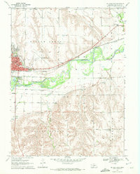
1970 Map of McCook East
USGS Topo · Published 1972About this map
Republican River irrigation systems and rail infrastructure dominate this 1970 snapshot of Red Willow County. The landscape is defined by the complex water engineering of the Meeker Canal and its Meeker Extension Canal, which cut through the terrain alongside the Burlington Northern railroad. The eastern portion of McCook is well-established here, showing educational landmarks like McCook College, St Patricks Sch, and the East Ward Sch. Outside the city center, the map transitions into the agricultural precincts of Willow Grove and Valley Grange. A rural community hub is visible to the southeast at St John Ch and the adjacent St John Cem. The integration of the McCook Municipal Airport and numerous Gravel Pits reflects the mid-century industrial and transit development of this Nebraska plains hub.
Find a feature on this map
29 named features on this map. Tap any name to fly to it.
Don’t see what you’re looking for? This feature index may not catch every label — zoom into the map to look around manually.
Map Details
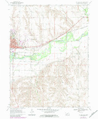
Editions of this 1970 McCook East Map
2 editions found
Other maps of this area

1954 · McCook
USGS Topo · 1:250,000

1957 · McCook
USGS Topo · 1:250,000

1957 · McCook SW
USGS Topo · 1:24,000

1957 · Danbury
USGS Topo · 1:24,000

1957 · McCook SE
USGS Topo · 1:24,000

1958 · McCook
USGS Topo · 1:250,000
1958 · Indianola
USGS Topo · 1:24,000

1970 · Red Willow Dam
USGS Topo · 1:24,000

1970 · McCook West
USGS Topo · 1:24,000

1970 · Quick SE
USGS Topo · 1:24,000