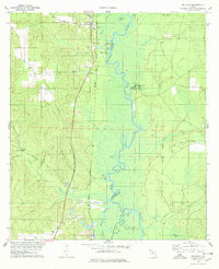
1978 Map of McDavid
USGS Topo · Published 1978About this map
The Escambia River meanders through this portion of the Florida Panhandle, serving as the natural boundary between Escambia and Santa Rosa counties. The landscape is defined by the river’s wide floodplain, featuring oxbows like Horseshoe Lake and Brown Lake, alongside several springs including Chumuckla Springs. Running parallel to the waterway, the Louisville and Nashville railroad anchors a string of small communities from McDavid in the north down through Bogia, Pine Barren, and Barth. These settlements reflect a late 1970s rural economy supported by local industries such as a Claypit near the tracks and agricultural activity. Small family landmarks and local heritage sites are scattered throughout the wooded terrain, including Rays Chapel and several burial sites like Coon Hill and Juniper Cem. Significant creek systems, such as Canoe Creek and Moore Creek, feed into the main river channel, highlighting the complex drainage of this lowland area.
Find a feature on this map
38 named features on this map. Tap any name to fly to it.
Don’t see what you’re looking for? This feature index may not catch every label — zoom into the map to look around manually.
Map Details
Editions of this 1978 McDavid Map
2 editions found
Other maps of this area

1920 · Milton
USGS Topo · 1:62,500

1921 · Muscogee
USGS Topo · 1:62,500

1941 · Muscogee
USGS Topo · 1:62,500

1941 · Milton
USGS Topo · 1:62,500

1941 · Century
USGS Topo · 1:62,500

1943 · Muscogee
USGS Topo · 1:62,500

1943 · Century
USGS Topo · 1:62,500

1943 · Milton
USGS Topo · 1:62,500

1943 · Jay
USGS Topo · 1:62,500

1957 · Pensacola
USGS Topo · 1:250,000