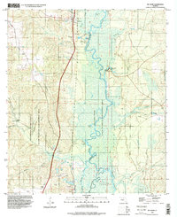
1994 Map of McDavid
USGS Topo · Published 1999About this map
The Escambia River meanders through a broad wetland basin along the border of Escambia and Santa Rosa counties, dominating the eastern half of this landscape. In the mid-1990s, the western uplands supported small settlements like McDavid, Bogia, and Barth, which grew along the north-south transportation corridor. This area reveals a transition from industrial and recreational land use, including the Champion International State Wildlife Management Area and various resource sites like a claypit and gravel pits, to quiet family landmarks. Genealogists may find value in the specific locations of several rural burial grounds, such as Coon Hill Cem and Juniper Cem, while water-based features like Chitmuckla Springs and Cotton Lake indicate the importance of the river system to the local environment and community life.
Find a feature on this map
36 named features on this map. Tap any name to fly to it.
Don’t see what you’re looking for? This feature index may not catch every label — zoom into the map to look around manually.
Map Details
Editions of this 1994 McDavid Map
2 editions found
Other maps of this area

1920 · Milton
USGS Topo · 1:62,500

1921 · Muscogee
USGS Topo · 1:62,500

1941 · Muscogee
USGS Topo · 1:62,500

1941 · Milton
USGS Topo · 1:62,500

1941 · Century
USGS Topo · 1:62,500

1943 · Muscogee
USGS Topo · 1:62,500

1943 · Century
USGS Topo · 1:62,500

1943 · Milton
USGS Topo · 1:62,500

1943 · Jay
USGS Topo · 1:62,500

1957 · Pensacola
USGS Topo · 1:250,000