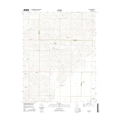
2015 Map of McGee
USGS Topo · Published 2015About this map
McGee serves as the central settlement point in this region of southeast Missouri, situated where the borders of Wayne and Bollinger counties meet. The landscape is defined by its numerous small basins and hollows, such as Manning Cabin Hollow and Lurker Hollow, which provide a complex network of drainage into McGee Cr and DeCelis Br. For those tracing local history, several family-named burial sites are mapped, including De Celis Cemetery, Richman Cemetery, and Wilfong Cemetery. The presence of distinct water features like Mulenex Lake, Sweet Asylum Hollow Lake, and Drum Lake indicates a varied topography where low-lying ponds contrast with higher elevations like Horsehead Knoll and Cow Knoll Ridge. This survey documents a quiet rural pocket where county roads and private lanes connect scattered homesteads and timbered tracts across the township lines.
Find a feature on this map
46 named features on this map. Tap any name to fly to it.
Don’t see what you’re looking for? This feature index may not catch every label — zoom into the map to look around manually.
Map Details
Editions of this 2015 McGee Map
This is the sole edition of this map. No revisions or reprints were ever made.
Other maps of this area

1934 · Greenville
USGS Topo · 1:62,500

1934 · Puxico
USGS Topo · 1:62,500

1935 · Poplar Bluff
USGS Topo · 1:62,500

1935 · Zalma
USGS Topo · 1:62,500

1939 · Greenville
USGS Topo · 1:62,500

1939 · Puxico
USGS Topo · 1:62,500

1939 · Zalma
USGS Topo · 1:62,500

1939 · Poplar Bluff
USGS Topo · 1:62,500

1949 · Rolla
USGS Topo · 1:250,000

1949 · Poplar Bluff
USGS Topo · 1:62,500