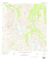
1958 Map of McGrath A-3
USGS Topo · Published 1964About this map
The Trimokish Hills dominate the central landscape of this interior Alaskan territory as it was documented in the late 1950s. The region is defined by its complex glacial-fed drainage systems, most notably the winding course of the Middle Fork Kuskokwim River and its tributary, the Windy Fork Middle Fork Kuskokwim River. In the southwestern portion of the quadrangle, the North Fork Big River carves through the terrain, illustrating the dramatic braided river patterns characteristic of the Alaska Range foothills. Published during the early years of statehood, this survey represents a period when much of the Bureau of Land Management territory remained unsurveyed and locations were predetermined via photogrammetric methods from aerial photographs. The absence of roads or trails on this sheet underscores the isolation of the Yukon-Koyukuk region before modern infrastructure reached these interior forks.
Find a feature on this map
4 named features on this map. Tap any name to fly to it.
Don’t see what you’re looking for? This feature index may not catch every label — zoom into the map to look around manually.
Map Details
Editions of this 1958 McGrath A-3 Map
2 editions found
Other maps of this area

1949 · McGrath
USGS Topo · 1:250,000

1950 · McGrath
USGS Topo · 1:250,000

1951 · Lime Hills
USGS Topo · 1:250,000

1954 · McGrath B-4
USGS Topo · 1:63,360

1954 · McGrath A-4
USGS Topo · 1:63,360

1954 · Lime Hills D-5
USGS Topo · 1:63,360

1958 · McGrath A-2
USGS Topo · 1:63,360

1958 · McGrath B-2
USGS Topo · 1:63,360

1958 · McGrath A-3
USGS Topo · 1:63,360
1958 · McGrath B-3
USGS Topo · 1:63,360