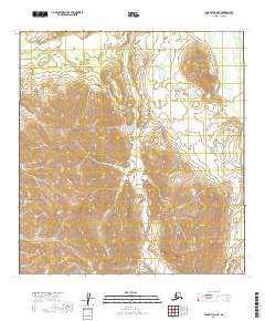
2019 Map of McGrath B-2 NE
USGS Topo · Published 2019About this map
The South Fork Kuskokwim River flows along the eastern edge of this interior landscape, marking a vital hydrological corridor within the Yukon-Koyukuk Census Area. This high-altitude terrain is defined by prominent peaks including Egypt Mtn in the northeast and Tunis Mtn to the south. The drainage patterns are clearly established by the Post River and the winding course of Tin Cr, which carves through the central valleys. Isolated water bodies like Veleska Lake and the High Lakes cluster are scattered throughout the interior, suggesting the varied alpine and sub-alpine environments typical of the Alaska Range foothills. The absence of roads or permanent structures underscores the wilderness character of this region during the early 21st century, where the landscape is shaped purely by its complex topography and glacial-fed waterways.
Find a feature on this map
13 named features on this map. Tap any name to fly to it.
Don’t see what you’re looking for? This feature index may not catch every label — zoom into the map to look around manually.
Map Details
Editions of this 2019 McGrath B-2 NE Map
This is the sole edition of this map. No revisions or reprints were ever made.
Other maps of this area

1949 · McGrath
USGS Topo · 1:250,000

1950 · McGrath
USGS Topo · 1:250,000

1958 · McGrath B-1
USGS Topo · 1:63,360

1958 · McGrath B-2
USGS Topo · 1:63,360

1958 · McGrath C-1
USGS Topo · 1:63,360

1958 · McGrath C-2
USGS Topo · 1:63,360

1958 · McGrath
USGS Topo · 1:250,000
2019 · McGrath B-2 SW
USGS Topo · 1:25,000
2019 · McGrath C-2 SW
USGS Topo · 1:25,000
2019 · McGrath B-2 NW
USGS Topo · 1:25,000