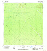
1958 Map of McGrath D-1
USGS Topo · Published 1968About this map
The Little Tonzona River carves through this remote interior landscape, where mid-century surveying recorded a environment defined by seasonal movement and sparse habitation. In the southeastern portion of the map, a Winter Trail provides the primary evidence of human passage across the drainage of Deepbank Creek. This route likely served as a vital corridor during the colder months when the surrounding wetlands and rivers were frozen and navigable by sledge or snowmachine.
Find a feature on this map
15 named features on this map. Tap any name to fly to it.
Don’t see what you’re looking for? This feature index may not catch every label — zoom into the map to look around manually.
Map Details
Editions of this 1958 McGrath D-1 Map
2 editions found

Other maps of this area

1949 · McGrath
USGS Topo · 1:250,000

1950 · Medfra
USGS Topo · 1:250,000

1950 · McGrath
USGS Topo · 1:250,000

1950 · Talkeetna
USGS Topo · 1:250,000

1951 · Talkeetna
USGS Topo · 1:250,000

1952 · Mount McKinley
USGS Topo · 1:250,000

1958 · Talkeetna D-6
USGS Topo · 1:63,360

1958 · Talkeetna C-6
USGS Topo · 1:63,360

1958 · McGrath D-2
USGS Topo · 1:63,360

1958 · Medfra A-2
USGS Topo · 1:63,360