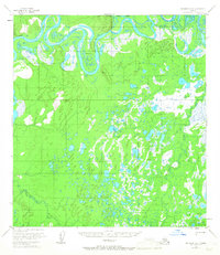
1953 Map of McGrath D-5
USGS Topo · Published 1967About this map
The Kuskokwim River snakes across the northern edge of this Interior Alaska landscape, its shifting channels creating a complex series of oxbow lakes and sloughs. Photogrammetric methods from 1952 aerial surveys reveal the intricate hydrology of the region, where the river makes a sharp turn at Stewart Bend. South of the main river valley, the terrain transitions into a dense network of countless unnamed thaw lakes and wetlands, drained by the meandering Katlitna River and Blackwater Creek. Vertical Angle Bench Marks like VABM Blair and VABM Kidney provide essential elevation data for this largely roadless area. This 1953 survey captures the territory just before statehood, documenting the wild hydrography of the Grayling Creek drainage and the vast marshlands that define the McGrath region.
Find a feature on this map
8 named features on this map. Tap any name to fly to it.
Don’t see what you’re looking for? This feature index may not catch every label — zoom into the map to look around manually.
Map Details
Editions of this 1953 McGrath D-5 Map
2 editions found
Other maps of this area

1949 · McGrath
USGS Topo · 1:250,000

1950 · Medfra
USGS Topo · 1:250,000

1950 · McGrath
USGS Topo · 1:250,000

1953 · McGrath D-5
USGS Topo · 1:63,360

1953 · McGrath C-4
USGS Topo · 1:63,360

1953 · McGrath D-4
USGS Topo · 1:63,360

1954 · Medfra A-6
USGS Topo · 1:63,360

1954 · McGrath D-6
USGS Topo · 1:63,360

1954 · Medfra A-5
USGS Topo · 1:63,360

1954 · McGrath C-6
USGS Topo · 1:63,360