
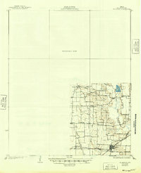
1929 Map of McKinney
USGS Topo · Published 1929About this map
The St Louis Southwestern railroad corridor defines the development of southern Collin County in this 1920s survey. Significant rural infrastructure is visible throughout the quadrant, including a high concentration of local educational sites like Winningkoff Sch, Morris Sch, and Parker Sch. The settlement of Wylie stands as a primary hub where the rail lines intersect, showcasing a grid of streets adjacent to the Gulf Colorado and Santa Fe tracks.
Find a feature on this map
21 named features on this map. Tap any name to fly to it.
Don’t see what you’re looking for? This feature index may not catch every label — zoom into the map to look around manually.
Map Details
Editions of this 1929 McKinney Map
2 editions found
Other maps of this area

1891 · Dallas
USGS Topo · 1:125,000

1893 · Dallas
USGS Topo · 1:125,000

1912 · Rockwall
USGS Topo · 1:31,680

1919 · Royse City
USGS Topo · 1:62,500

1924 · Farmersville 3-c
USGS Topo · 1:48,000

1924 · Mc Kinney 4-d
USGS Topo · 1:48,000

1929 · Frisco
USGS Topo · 1:62,500

1930 · Farmersville
USGS Topo · 1:62,500

1931 · Carrollton
USGS Topo · 1:62,500

1954 · Dallas
USGS Topo · 1:250,000