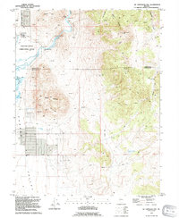
1994 Map of McTarnahan Hill
USGS Topo · Published 1994About this map
Prison Hill and the Northern Nevada Correctional Center anchor this mid-1990s landscape at the boundary of Carson City and Douglas County. The Carson River winds through the northwestern corner, passing the McTarnahan Bridge (Site) and the Mexican Dam. This terrain is a mix of high-desert industrial and natural features, where the valley floor transitions into the heights of Hot Springs Mountain and McTarnahan Hill.
Find a feature on this map
28 named features on this map. Tap any name to fly to it.
Don’t see what you’re looking for? This feature index may not catch every label — zoom into the map to look around manually.
Map Details
Editions of this 1994 McTarnahan Hill Map
This is the sole edition of this map. No revisions or reprints were ever made.
Other maps of this area

1889 · Markleeville
USGS Topo · 1:125,000

1891 · Carson
USGS Topo · 1:125,000

1891 · Markleeville
USGS Topo · 1:125,000

1893 · Carson
USGS Topo · 1:125,000

1893 · Markleeville
USGS Topo · 1:125,000

1948 · Walker Lake
USGS Topo · 1:250,000

1956 · Freel Peak
USGS Topo · 1:62,500

1956 · Dayton
USGS Topo · 1:62,500

1956 · Carson City
USGS Topo · 1:62,500

1957 · Walker Lake
USGS Topo · 1:250,000