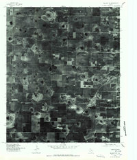
1976 Map of Meadow NW
USGS Topo · Published 1978About this map
Ropesville stands as the primary community in this aerial orthophotograph of the Texas High Plains, captured in the mid-1970s. The image reveals a highly organized agricultural landscape defined by the geometry of the South Plains, where square-mile sections are etched with the patterns of industrial farming. Distinct circular irrigation marks and the subtle depressions of playa lakes dot the terrain, contrasting with the rigid grid of rural roads. The town of Ropesville is situated along a prominent diagonal transportation corridor, showing its compact residential blocks and industrial sites adjacent to the rail line. This orthophotoquad provides a clear view of the rural-industrial interface during a period of significant agricultural development in Hockley County, documenting the precise footprint of the town and its surrounding farmsteads before late-twentieth-century changes.
Find a feature on this map
1 named feature on this map. Tap any name to fly to it.
Don’t see what you’re looking for? This feature index may not catch every label — zoom into the map to look around manually.
Map Details
Editions of this 1976 Meadow NW Map
This is the sole edition of this map. No revisions or reprints were ever made.
Other maps of this area

1954 · Brownfield
USGS Topo · 1:250,000

1957 · Meadow
USGS Topo · 1:62,500

1957 · Wolfforth
USGS Topo · 1:62,500

1958 · Brownfield
USGS Topo · 1:250,000

1962 · Brownfield
USGS Topo · 1:250,000

1965 · Levelland East
USGS Topo · 1:24,000

1965 · Lockettville
USGS Topo · 1:24,000

1969 · Sundown SE
USGS Topo · 1:24,000

1976 · Wolfforth SE
USGS Topo · 1:24,000
1976 · Meadow NE
USGS Topo · 1:24,000