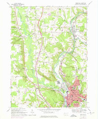
1968 Map of Meadville
USGS Topo · Published 1975About this map
Meadville serves as the industrial and transportation hub of central Crawford County in this detailed mid-century survey. The landscape is defined by the winding course of French Creek, which is flanked by the competing tracks of the Erie-Lackawanna and the Bessemer and Lake Erie railroads. These rail lines supported the city's growth, evidenced by the dense grid of streets near the courthouse and City Hall. Beyond the urban center, the map reveals a traditional network of agricultural crossroads and family-named locales like Coons Corners and Blacks Corner. The presence of the County Fairgrounds and Port Meadville Airport indicates the regional importance of this valley. To the north, Saegertown sits at the junction where Woodcock Creek meets the main river, surrounded by upland farms and institutions like the County Home Cem.
Find a feature on this map
85 named features on this map. Tap any name to fly to it.
Don’t see what you’re looking for? This feature index may not catch every label — zoom into the map to look around manually.
Map Details
Editions of this 1968 Meadville Map
4 editions found
Other maps of this area

1900 · Girard
USGS Topo · 1:62,500

1906 · Linesville
USGS Topo · 1:62,500

1908 · Linesville
USGS Topo · 1:62,500

1923 · Meadville
USGS Topo · 1:62,500

1923 · Cambridge Springs
USGS Topo · 1:62,500

1925 · Meadville
USGS Topo · 1:62,500

1925 · Cambridge Springs
USGS Topo · 1:62,500

1943 · Meadville
USGS Topo · 1:62,500

1943 · Cambridge Springs
USGS Topo · 1:62,500

1950 · Cleveland
USGS Topo · 1:250,000