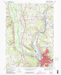
1968 Map of Meadville
USGS Topo · Published 1990About this map
Meadville serves as the industrial and educational heart of Crawford County on this 1960s-era survey, which shows the city and surrounding townships during a period of steady development. The campus of Allegheny College and major medical facilities like City Hospital and Spencer Hospital anchor the urban core, while the presence of the Bessemer and Lake Erie and Conrail lines highlights the area's rail-dependent economy. The landscape is defined by the winding paths of French Creek and Cussewago Creek, which converge south of the city center.
Find a feature on this map
80 named features on this map. Tap any name to fly to it.
Don’t see what you’re looking for? This feature index may not catch every label — zoom into the map to look around manually.
Map Details
Editions of this 1968 Meadville Map
4 editions found
Other maps of this area

1900 · Girard
USGS Topo · 1:62,500

1906 · Linesville
USGS Topo · 1:62,500

1908 · Linesville
USGS Topo · 1:62,500

1923 · Meadville
USGS Topo · 1:62,500

1923 · Cambridge Springs
USGS Topo · 1:62,500

1925 · Meadville
USGS Topo · 1:62,500

1925 · Cambridge Springs
USGS Topo · 1:62,500

1943 · Meadville
USGS Topo · 1:62,500

1943 · Cambridge Springs
USGS Topo · 1:62,500

1950 · Cleveland
USGS Topo · 1:250,000