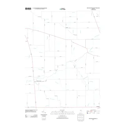
2013 Map of Mechanicsburg
USGS Topo · Published 2013About this map
The small settlements of Mechanicsburg and Cyclone anchor this 2013 landscape, characterized by an extensive network of drainage ditches and creeks that define the agricultural character of central Indiana. The meandering course of Sugar Creek flows through the central portion of the quadrangle, joined by tributaries such as Mud Creek and Browns Wonder Creek. The map reveals a highly managed hydrologic system, with numerous named waterways like Woods Ditch, Taylor Ditch, and Scott Wincoop Ditch providing critical drainage to the surrounding farmland.
Find a feature on this map
74 named features on this map. Tap any name to fly to it.
Don’t see what you’re looking for? This feature index may not catch every label — zoom into the map to look around manually.
Map Details
Editions of this 2013 Mechanicsburg Map
This is the sole edition of this map. No revisions or reprints were ever made.
Other maps of this area

1953 · Rosston
USGS Topo · 1:24,000

1953 · Lebanon
USGS Topo · 1:24,000

1953 · Danville
USGS Topo · 1:250,000

1955 · Danville
USGS Topo · 1:250,000

1956 · Danville
USGS Topo · 1:250,000

1961 · Michigantown
USGS Topo · 1:24,000

1961 · Mechanicsburg
USGS Topo · 1:24,000

1961 · Hillisburg
USGS Topo · 1:24,000

1961 · Frankfort
USGS Topo · 1:24,000
1961 · Kirklin
USGS Topo · 1:24,000