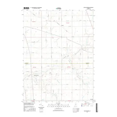
2016 Map of Mechanicsburg
USGS Topo · Published 2016About this map
Mechanicsburg and Cyclone anchor this central Indiana landscape, where the survey captures a patchwork of agricultural fields defined by an extensive network of drainage infrastructure. The rural character of the region is punctuated by family and community history found in sites like Garrett Cem and McIntire Cem. The terrain is shaped by numerous waterways including Sugar Creek and Prairie Cr, which are supported by a complex system of man-made channels such as Woods Ditch and Taylor Ditch. These ditches reflect the intensive land-management required for the area's agricultural productivity. Further south, the settlements of Pike and Elizaville appear near the boundary of Clinton and Boone counties. The map also traces established transportation routes like E Kirklin Brick Rd, connecting the scattered homesteads and small towns that have long defined these crossroads.
Find a feature on this map
50 named features on this map. Tap any name to fly to it.
Don’t see what you’re looking for? This feature index may not catch every label — zoom into the map to look around manually.
Map Details
Editions of this 2016 Mechanicsburg Map
This is the sole edition of this map. No revisions or reprints were ever made.
Other maps of this area

1953 · Rosston
USGS Topo · 1:24,000

1953 · Lebanon
USGS Topo · 1:24,000

1953 · Danville
USGS Topo · 1:250,000

1955 · Danville
USGS Topo · 1:250,000

1956 · Danville
USGS Topo · 1:250,000

1961 · Michigantown
USGS Topo · 1:24,000

1961 · Mechanicsburg
USGS Topo · 1:24,000

1961 · Hillisburg
USGS Topo · 1:24,000

1961 · Frankfort
USGS Topo · 1:24,000
1961 · Kirklin
USGS Topo · 1:24,000