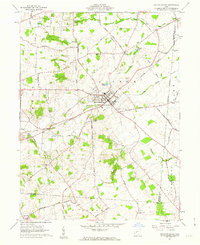
1961 Map of Mechanicsburg
USGS Topo · Published 1962About this map
Mechanicsburg serves as the central hub of this West Central Ohio landscape, where the New York Central railroad cuts a diagonal path through Champaign County. The 1961 terrain is defined by a dense network of country roads named for local families and destinations, such as Bellefontaine Road and Van Ness Road. Waterways like Little Darby Creek and Treacle Creek dictate the rural layout, with numerous small burial grounds and churches anchoring the surrounding agricultural communities. Genealogists will find a wealth of specific landmarks, including Maple Grove Cemetery, Oak Grove Cem, and Hazel Cem. Smaller settlements like Stringtown, Enterprise, and Five Points appear alongside vanished industrial sites, such as the Borrow Pit and various Sand and Gravel Pits, which reveal the mid-century transition from traditional farming to more diverse land use near the Madison and Clark County borders.
Find a feature on this map
68 named features on this map. Tap any name to fly to it.
Don’t see what you’re looking for? This feature index may not catch every label — zoom into the map to look around manually.
Map Details
Editions of this 1961 Mechanicsburg Map
2 editions found
Other maps of this area

1907 · London
USGS Topo · 1:62,500

1907 · South Charleston
USGS Topo · 1:62,500

1914 · Mechanicsburg
USGS Topo · 1:62,500

1916 · Mechanicsburg
USGS Topo · 1:62,500

1916 · Milford Center
USGS Topo · 1:62,500

1944 · Mechanicsburg
USGS Topo · 1:62,500

1944 · Milford Center
USGS Topo · 1:62,500

1947 · Columbus
USGS Topo · 1:250,000

1950 · Marion
USGS Topo · 1:250,000

1961 · Columbus
USGS Topo · 1:250,000