1953 Map of Medanales
USGS Topo · Published 1971About this map
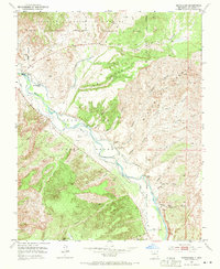
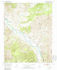
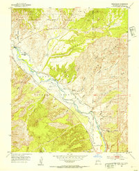
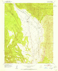
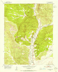
The Rio Chama valley anchors this mid-century portrait of northern New Mexico, where the intricate network of water management is visible through numerous Ditch segments supporting local agriculture. This landscape is largely defined by the historical boundaries of the Juan Jose Lobato Grant, which covers a significant portion of the terrain alongside the Carson National Forest. The small settlement of Medanales is the primary community center, featuring the San Antonio Church as a focal point for the valley's residents. High-desert geography dominates the surroundings, characterized by a complex system of drainage such as Cañada Ancha and Arroyo de las Pinedas. Toward the west, landmarks like the Quarter Circle Ranch and the geological formation of Window Rock mark the edge of the valley, while the northern reaches transition into higher elevations marked by the Rito del Oso and Rito del Perro.
Find a feature on this map
38 named features on this map. Tap any name to fly to it.
Don’t see what you’re looking for? This feature index may not catch every label — zoom into the map to look around manually.
Map Details
Editions of this 1953 Medanales Map
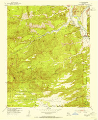
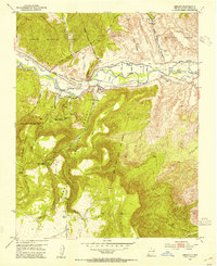
Other maps of this area

1918 · Abiquiu
USGS Topo · 1:125,000
1953 · Chili
USGS Topo · 1:24,000
1953 · Abiquiu
USGS Topo · 1:24,000
1953 · Medanales
USGS Topo · 1:24,000
1953 · Vallecitos
USGS Topo · 1:24,000
1953 · San Juan Pueblo
USGS Topo · 1:24,000
1953 · Lyden
USGS Topo · 1:24,000
1953 · El Rito
USGS Topo · 1:24,000
1953 · Ojo Caliente
USGS Topo · 1:24,000
1953 · Canjilon SE
USGS Topo · 1:24,000