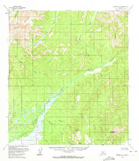
1953 Map of Medfra B-4
USGS Topo · Published 1972About this map
The Sunshine Mountains and Mystery Mountains dominate this 1953 interior Alaskan landscape, framing a vast network of drainages and peaks. The central feature is the broad, swampy valley of the Nixon Fork, which meanders through the terrain and collects numerous tributaries such as Jones Creek and Meadow Creek. The map reveals a land defined entirely by its natural hydrology and high points, with no roads or settlements present at the time of the mid-century field annotation.
Find a feature on this map
17 named features on this map. Tap any name to fly to it.
Don’t see what you’re looking for? This feature index may not catch every label — zoom into the map to look around manually.
Map Details
Editions of this 1953 Medfra B-4 Map
2 editions found
Other maps of this area

1950 · Medfra
USGS Topo · 1:250,000

1953 · Medfra B-4
USGS Topo · 1:63,360

1953 · Medfra B-5
USGS Topo · 1:63,360

1953 · Medfra C-4
USGS Topo · 1:63,360

1954 · Medfra A-5
USGS Topo · 1:63,360

1954 · Medfra C-5
USGS Topo · 1:63,360

1954 · Medfra C-3
USGS Topo · 1:63,360

1954 · Medfra A-3
USGS Topo · 1:63,360

1955 · Medfra B-3
USGS Topo · 1:63,360
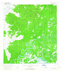
1959 · Medfra A-4
USGS Topo · 1:63,360