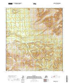
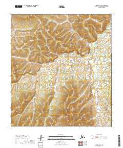
2019 Map of Medfra B-5 NE
USGS Topo · Published 2019About this map
The Sunshine Mountains dominate the northeastern corner of this interior Alaskan landscape, while the lower reaches of the Kuskokwim Mountains stretch across the southwestern terrain. This 2019 survey documents a wilderness primarily defined by its drainage patterns and vertical relief, with Washington Cr flowing through the extreme southeastern section of the quadrangle. The map illustrates the transition between these two prominent mountain systems within the Yukon-Koyukuk Census Area. Without established roads or settlements, the area is defined by its topographic character and the jurisdictional boundaries of Township 23 South and Township 24 South. This document serves as a record of the remote interior before any modern infrastructure development, highlighting the natural contours and hydrologic features of the subarctic environment.
Find a feature on this map
7 named features on this map. Tap any name to fly to it.
Don’t see what you’re looking for? This feature index may not catch every label — zoom into the map to look around manually.
Map Details
Editions of this 2019 Medfra B-5 NE Map
This is the sole edition of this map. No revisions or reprints were ever made.
Other maps of this area

1950 · Medfra
USGS Topo · 1:250,000

1953 · Medfra B-4
USGS Topo · 1:63,360

1953 · Medfra B-5
USGS Topo · 1:63,360

1953 · Medfra C-4
USGS Topo · 1:63,360

1954 · Medfra C-5
USGS Topo · 1:63,360

1959 · Medfra
USGS Topo · 1:250,000
2019 · Medfra B-4 NW
USGS Topo · 1:25,000
2019 · Medfra B-5 NW
USGS Topo · 1:25,000
2019 · Medfra B-4 SW
USGS Topo · 1:25,000
2019 · Medfra C-5 SW
USGS Topo · 1:25,000