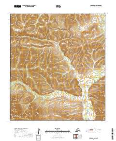
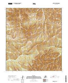
2019 Map of Medfra B-5 NW
USGS Topo · Published 2019About this map
Kuskokwim Mountains terrain dominates this 2019 survey, characterized by a series of high ridges and narrow drainage valleys. The hydrology is primarily defined by the headwaters and tributaries of the W Fork Nixon Fork, which carves through the undulating landscape. This portion of the Alaska interior is sparsely developed, shown here in a transitional state where the natural contours of the land remain the primary features of interest. The map illustrates the complex vertical relief of the region, providing a detailed record of the elevations and watercourses that define the local geography before any significant human infrastructure was established in this specific quadrant.
Find a feature on this map
9 named features on this map. Tap any name to fly to it.
Don’t see what you’re looking for? This feature index may not catch every label — zoom into the map to look around manually.
Map Details
Editions of this 2019 Medfra B-5 NW Map
This is the sole edition of this map. No revisions or reprints were ever made.
Other maps of this area

1950 · Medfra
USGS Topo · 1:250,000

1953 · Medfra B-5
USGS Topo · 1:63,360

1954 · Medfra C-6
USGS Topo · 1:63,360

1954 · Medfra C-5
USGS Topo · 1:63,360

1954 · Medfra B-6
USGS Topo · 1:63,360

1959 · Medfra
USGS Topo · 1:250,000
2019 · Medfra C-6 SE
USGS Topo · 1:25,000
2019 · Medfra C-5 SW
USGS Topo · 1:25,000
2019 · Medfra C-5 SE
USGS Topo · 1:25,000
2019 · Medfra B-6 NE
USGS Topo · 1:25,000