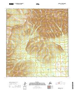
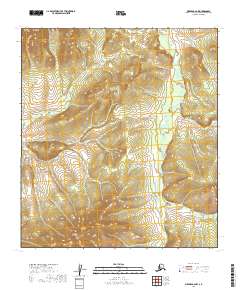
2019 Map of Medfra B-6 SE
USGS Topo · Published 2019About this map
Kuskokwim Mountains terrain dominates this 2019 survey of the Alaskan interior within the Medfra quadrangle. This specific portion of the range is characterized by a series of north-south ridges and high elevations, most notably the peak at Page Mtn in the northern section of the sheet. The landscape is primarily defined by the Public Land Survey System grid, which divides the territory into various townships including t25s r17e and t26s r17e. Devoid of modern infrastructure or named settlements, the map illustrates the raw topography of the Yukon-Koyukuk region, revealing the intricate drainage patterns and steep elevation changes that characterize this subarctic environment before any significant human development or road networks were established in these sections of the interior.
Find a feature on this map
10 named features on this map. Tap any name to fly to it.
Don’t see what you’re looking for? This feature index may not catch every label — zoom into the map to look around manually.
Map Details
Editions of this 2019 Medfra B-6 SE Map
This is the sole edition of this map. No revisions or reprints were ever made.
Other maps of this area

1950 · Medfra
USGS Topo · 1:250,000

1953 · Medfra B-5
USGS Topo · 1:63,360

1954 · Medfra A-6
USGS Topo · 1:63,360

1954 · Medfra A-5
USGS Topo · 1:63,360

1954 · Medfra B-6
USGS Topo · 1:63,360

1959 · Medfra
USGS Topo · 1:250,000
2019 · Medfra A-6 NW
USGS Topo · 1:25,000
2019 · Medfra A-6 NE
USGS Topo · 1:25,000
2019 · Medfra B-5 NW
USGS Topo · 1:25,000
2019 · Medfra B-6 NW
USGS Topo · 1:25,000